
SERVICE: YouTube
Galileo Innovation Challenge 29.11. - 1.12.2019
When you move to the YouTube website, please note that YouTube has its own cookie and privacy policies.
You can watch the video here:
Harvest a pumpkin, play in a labyrinth or identify an interference in the satellite navigation signal. These ideas won the Galileo Innovation Challenges.
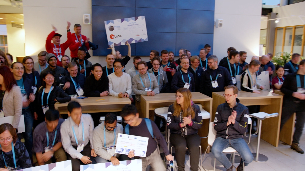
The Galileo Innovation Challenge hackathon, which took place in Helsinki on 29 November – 1 December, gathered around 50 competitors in 19 teams to innovate on ways of using the EU's Galileo satellite positioning. The event was hosted by the Finnish Transport and Communications Agency Traficom.
Positioning chips and modules manufacturer u-blox, technology company DA-Group, and the European GNSS Agency (GSA), which manages the Galileo system, set the competition challenges and mentored the teams. The teams concentrated on using Galileo's advanced location information in smartphone applications, focused on detecting anomalies and interference in the positioning signal, and looked for solutions that provided centimetre positioning accuracy for robotics applications.
The event organisers were delighted by the team's diverse and creative approach.
The winners of the challenge set by u-blox experimented on how top-level location information could be used in agricultural robotics. They developed an application that uses aerial imagery and location data to automate pumpkin harvesting in the field. The competitors demonstrated the application with a scaled-down autonomous robot that picked mandarins off the table.
The winners of the GSA challenge implemented a functional game to create and solve virtual labyrinths outdoors. The application uses the enhanced positioning accuracy of the Galileo system to track the player's progress through the virtual labyrinth. The winning uMaze app is available for free from the app store for Android and iPhone devices.
In the DA-Group challenge, first prize went to an unsupervised machine learning algorithm, which detects anomalies and interferences in the satellite navigation signal. In operationally critical applications such as autonomous transport, the reliability of location information is vital. The winning algorithm successfully detected distortions in the satellite signal caused by the earth's atmosphere and solar activity.
When you move to the YouTube website, please note that YouTube has its own cookie and privacy policies.
With digitalisation, satellite navigation has become a significant part of our daily lives. For example, operating electricity networks and transport services requires satellite positioning and accurate time information.
Finnish expertise has been involved in numerous space and satellite projects in recent decades. In recent years, Finland has built its first satellites and our country is becoming a new player in the satellite market. With Galileo, Finnish engineering expertise in the gaming world and in traditional industries is gaining new tools for building even more powerful applications. The added value that Galileo brings to its users is generated by applications used on earth. Strong software expertise is a clear benefit to the Finnish business community as new technology enabled solutions to product and service models are being developed.
"A comprehensive application platform will ensure that Finnish industry and application developers are at the forefront of bringing Galileo-based services to the market," said Jarkko Saarimäki, Director of the National Cyber Security Center at the Finnish Transport and Communications Agency Traficom.
Galileo, a satellite navigation system built by the European Union, provides very accurate positioning and timing information. Galileo is operated by the European Global Navigation Satellite Systems Agency (GSA) under the guidance of EU member states. Unlike the American GPS or the Russian GLONASS, Galileo is the only satellite positioning system in the world operated by civilian authorities.
Europe is at an important stage in the development of satellite navigation. The Galileo system that went live in 2016 will move to a full performance phase in 2020. This is when the system will be formally declared operational. However, many consumers are unknowingly using Galileo, as much of today's consumer-oriented mobile phones and smart devices already use signals from Galileo satellites.
In addition, Galileo's Search and Rescue (SAR) service, which is part of the Cospas-Sarsat programme, already provides security for mountaineers, off-piste skiers and seafarers.
The development of the Galileo system is continuing. In the next few years it will provide, in addition to traditional positioning and timing information, high accuracy positioning (to approximately 20 cm accuracy) and a signal authentication service for operationally critical applications.
The satellite navigation market is growing and the European Commission estimated it to be worth over €70 billion in 2017. The market is expected to grow to €195 billion by 2025 due to the development of autonomous transport solutions, 5G and IoT systems.
The original article was published on 20.12.2019 in Finnish. (External link)
Senior Specialist Tero Vihavainen, tel: 029 539 0121
Email: firstname.lastname@traficom.fi
Watch the Galileo Innovation Challenge video on YouTube. (External link)
Read more about Galileo Innovation Challenge. (External link)