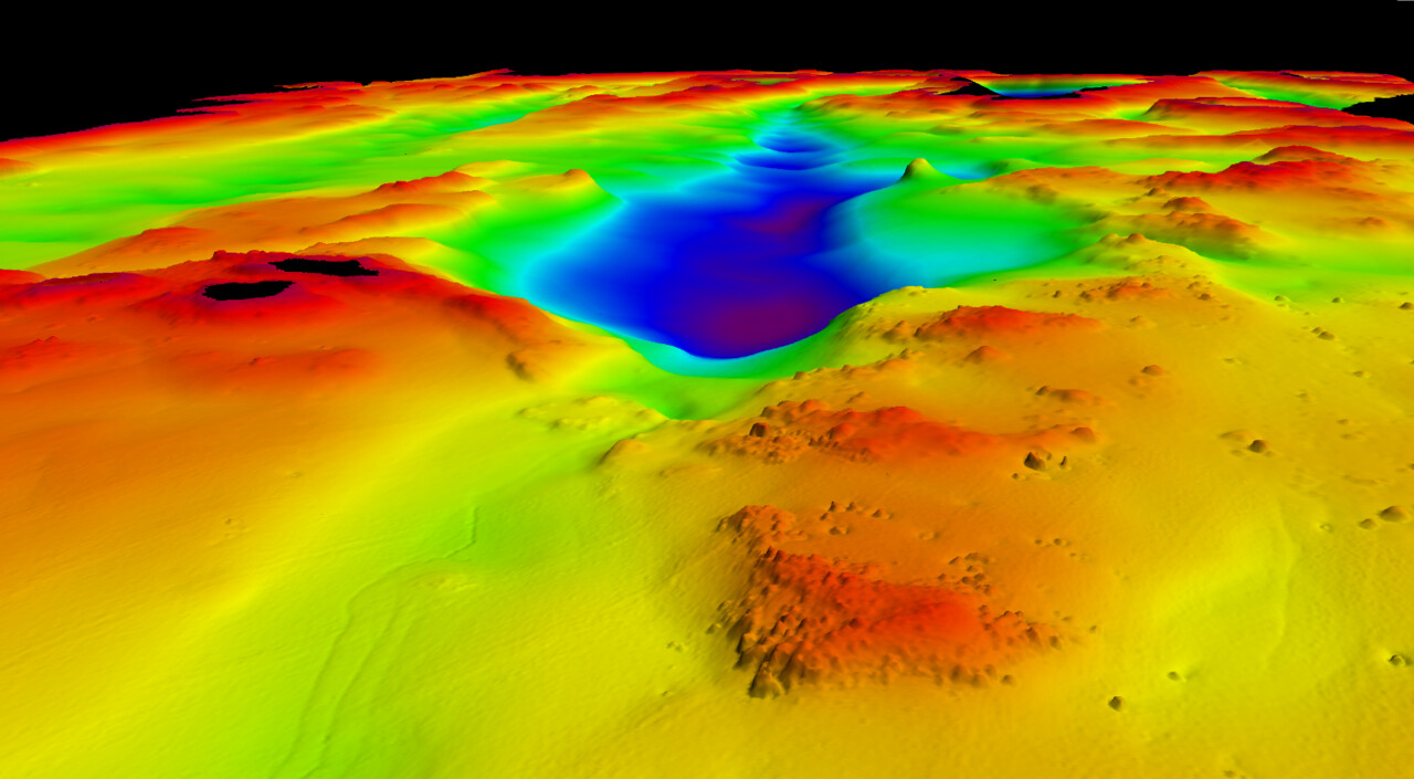
Hydrographic surveys are used to produce bathymetric data, for example, for the creation of nautical charts, the planning and maintenance of fairways, and the design and implementation of construction projects. Bathymetric data consist of either comprehensive point-based measurements or line-based measurements.
Availability of bathymetric data
Bathymetric data is available from the economic zone of the sea as well as from the Vuoksi and Kymijoki water systems without a permit procedure. It is also possible to obtain bathymetric data from other Finnish sea areas through a permit procedure. The coverage and reliability of the data vary depending on the time and location of the hydrographic surveys.
The Regional Surveillance Act restricts systematic measurement and recording of seabed formations within Finland’s territorial waters. According to the Act on the Openness of Government Activities, depth data may be classified as confidential information.
If the data has a security classification, it imposes conditions on its release. For this reason, not all data requests can be fulfilled. Traficom evaluates the conditions for data release based on an application for right to use bathymetric data.
If you need bathymetric data, follow these steps
Check whether the bathymetric data is available as open data
Bathymetric data, such as depth contours, depth areas, and depth points, can be downloaded for free via the Finnish Transport and Communications Agency’s (Traficom) viewing and download service. The data are also available through an interface service.
Request for bathymetric data electronically
If the bathymetric data you need is not available through open data, you can request the data through the electronic service. The service can be found under My e-services > Information Services and Hydrographic Data.
- Fill in the contact details of the applicant
- Specify the location from which you are ordering the depth survey data
- Indicate if you already have a permit for using depth survey data
- State the intended use of the depth survey data
- Provide billing information
The pricing for data delivery is based on the number of working hours required for the task. The hourly rate is €200/hour + VAT (minimum charge 1 hour).
Please note that if the data request is made on behalf of a company or organization, the person submitting the request must have signing authority for the company/organization or a power of attorney (for handling permits and notifications related to maritime traffic) from a person who has such authority.
Prepare the mandatory attachments
When ordering data through the electronic service, an area boundary for the location from which you are ordering bathymetric data must be attached. The area boundary must be provided as a separate zipped Shape file.
We will verify whether the data delivery requires a permit and whether the data is classified for information security. We will contact you if the data delivery requires a permit or if the data request cannot be fulfilled.
You will receive a download link via email
Traficom uses the ShareFile file-sharing service for data delivery. We will send you a download link to the data via email.
We will issue an invoice once the data has been delivered.
Product description of depth measurement data
Depth measurement data is delivered in raster format as a GeoTIFF file. It is a depth model product where the cell values represent the depth from measurement observations within each cell area. The product is continuously updated, and its coverage expands with new hydrographic surveys. The depth model may consist of surveys conducted at different times and with different methods.
| Coordinate system and vertical datum | ETRS-TM35FIN (EPSG:3067) N2000 height system (EPSG:3900), which corresponds to BSCD2000 (EPSG:10678) as the reference level for depths in Finnish marine areas. |
| Resolutuon | 1 m |
| Cell values | shallowest depth, average depth, deepest depth |
Terms of use
The public depth measurement data is licensed under Creative Commons 4.0 (External link)The source of the data must be attributed as required by the license.
Traficom requires the following attribution format when using the data:
"Source: Finnish Transport and Communications Agency. Not for navigational use. Does not meet the requirements of an official nautical chart."
Usage terms for confidential data are defined in the data release agreement.

More information
syvyysmittausaineistot(at)traficom.fi