A new era in navigation is approaching – the implementation of the S-100 standards begins in early 2026
The digitalization of the maritime sector is taking a concrete step forward as the first S-100 products become available in early 2026.
The S-100 product portfolio offers the maritime sector a new generation of navigation products and services by integrating information from different sources and presenting it in a unified way. S-100 enhances safety, efficiency, and environmental sustainability in shipping by leveraging digital technology and standardized information exchange.
Key industry stakeholders are actively collaborating to promote the introduction of the new navigation products and gathered in October in Helsinki to share information and familiarize themselves with the demo versions of the first-phase S-100 products. With the first phase of the standardization work now completed, the next step is to deliver the first S-100 navigation products and services to users.
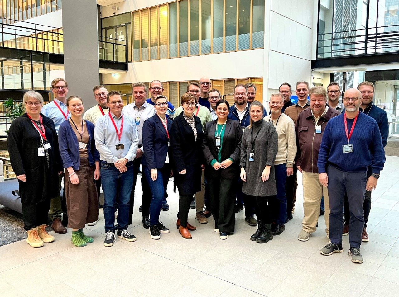
The organizations producing the first-phase S-100 data and the stakeholders participating in the standardization work gathered for a workshop in Kumpula.
The event was organized as part of the national development work for S-100 products, which Traficom has coordinated since 2022. The development work also involves the Finnish Meteorological Institute, the Finnish Transport Infrastructure Agency, and Fintraffic. In addition to the organizations producing S-100 data, Furuno Finland Oy and Finnpilot also participated in the event, giving attendees the opportunity to experience the latest technological developments in practice.
The first-phase S-100 navigation products and services are progressing toward production
Starting in 2026, a series of product launches will begin, continuing into 2027. At the beginning of 2026, the first S-100 product, “Vilkku”, is expected to be launched. This navigational warning service has been developed in collaboration between Traficom and Fintraffic and is based on the S-124 data standard. It will be followed by S-101, electronic nautical charts, and S-102, the bathymetric model, production testing of these products is already underway. In addition, S-104, providing water level information, and S-111, describing surface currents, will also be launched.
Electronic nautical chart S-101 and bathymetric model S-102
At the workshop, Teppo Kuusijärvi from Traficom presented the progress and upcoming stages in the development of the electronic nautical chart S-101 and the bathymetric model S-102. The operational versions of the S-101 and S-102 standards were approved in January 2025, and the production process is currently being tested at Traficom.
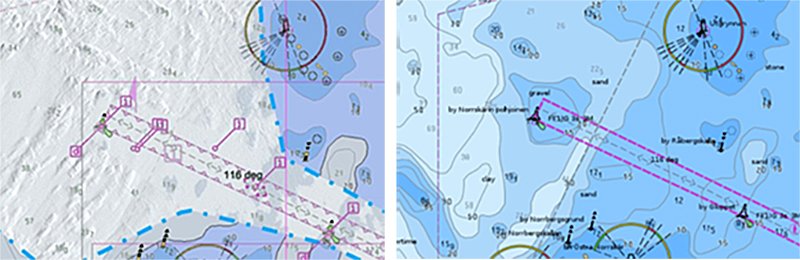
On the left, S-101 and S-102 data are shown together; on the right, S-57 ENC data.
According to current plans, S-101 products will be available for all Finnish sea areas before the end of 2026, and for the Saimaa region in 2027. For S-102, the goal is to begin launching products for fairway areas (fairway classes 1 and 2) during 2026. The products will be delivered to end users via Traficom’s partner PRIMAR, which is responsible for the distribution of electronic navigation products.
Water level and surface current products become part of electronic nautical charts
The Finnish Meteorological Institute is working on the development of navigation products that describe water levels S-104 and surface currents S-111. Anni Jokiniemi from the Finnish Meteorological Institute presented the progress made in this development work. These weather-related products will be published as part of the first phase of the S-100 portfolio.
The water level product S-104 works together with the bathymetric model S-102 and the electronic nautical chart S-101. It provides mariners with depth information corrected for current water levels. Water level data is also available as forecasts, for example, for route planning. S-111, in turn, visualizes surface currents in the chart view of ECDIS systems.
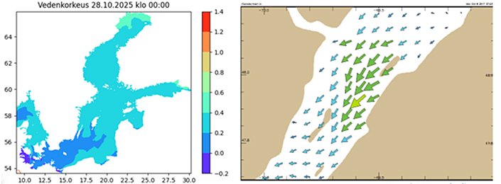
Example images from the water level product S-104 on the left and the surface current product S-111 on the right.
The S-124 standard for presenting navigational warnings directly in the ECDIS system
Janne Virtanen from Traficom and Juho Pitkänen from Fintraffic presented the jointly developed “Vilkku” service, which is based on the S-124 data standard. The service makes it possible to display navigational warnings directly in the ECDIS system.
Currently, navigational warnings are communicated to ships via NAVTEX and VHF, these channels will continue to be used alongside the new system for an extended period. Through the "Vilkku" project, S-124 could become the first S-100 product to be published in Finland. The service is planned to be launched in early 2026.
Overview of the phase two S-100 products
Stefan Engström from Traficom presented the S-98 interoperability standard as well as the plans for the upcoming S-100 products – the so-called “Phase 2” products. The S-98 standard defines the requirements for ECDIS manufacturers on how different S-100 products should work together and specifies which products an S-100-compatible ECDIS must support.
S-100 type-approved ECDIS equipment, in addition to Phase 1 products, must be able to read and display the following data types from Phase 2:
• S-122 (Marine protected areas)
• S-123 (Marine Radio Services)
• S-127 (Marine Traffic Management)
• S-131 (Marine Harbour Infrastructure)
These data standards are currently being developed by the IHO (International Hydrographic Organization) and are expected to be completed and operational during 2026, after which they can begin to be produced and distributed as official navigation products.
Optional additional products include S-125 (Marine aids to navigation) and S-411, which describes ice conditions and S-412 warnings related to maritime weather hazards.
Phase 2 weather-related products (S-400 series) are being developed under the World Meteorological Organization (WMO). Patrick Eriksson and Anni Jokiniemi from the Finnish Meteorological Institute presented the products in the S-400 series, which, in addition to S-411 and S-412, also include S-413 (marine weather forecasts) and S-414 (marine weather observations). Development work for the last two products has not yet begun.
The demonstrations illustrated the first-phase S-100 products in practice
During the demonstrations by Mika Laasonen Finnpilot and Petri Tissari from Furuno Finland, participants were able to see how the S-100 data products function in practice and are visualized for the end user.
The demonstrations showed how the electronic nautical charts S-101, the bathymetric model S-102, as well as surface currents S-111 and water level information S-104 work together in an ECDIS system, forming an integrated and interactive whole. The demo also showed how depth values in the nautical chart are corrected according to the water level information from S-104.
In addition, it was demonstrated how the S-102 bathymetric model allows for a more detailed representation of depth data, which also enables a more accurate safety contour to be calculated for a vessel based on its draft. This increased precision has proven particularly valuable for pilots when studying fairways and planning pilotage.
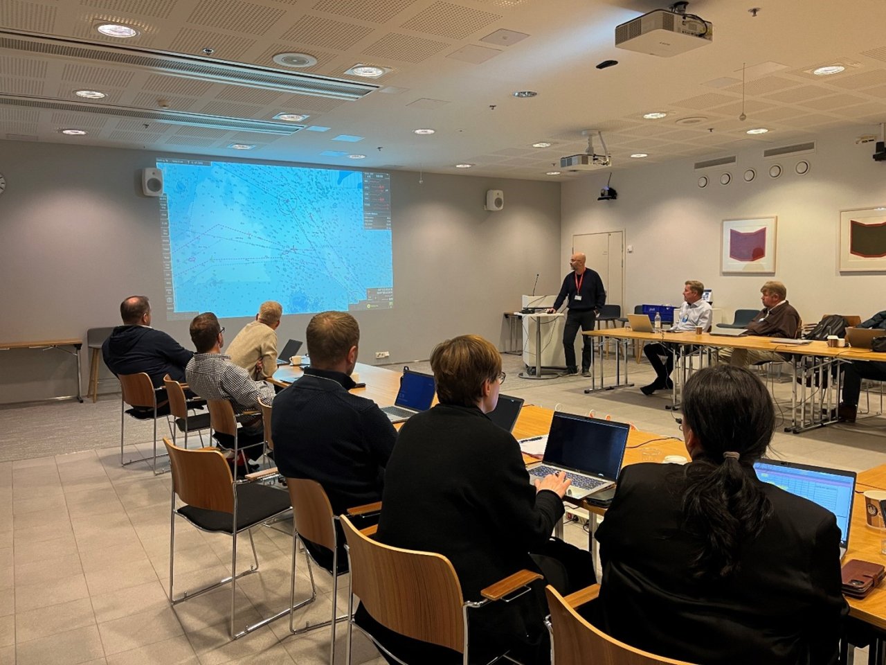
Furuno Finland Oy demonstrated how the S-102, S-104, and S-111 products work together, visualizing depth data and surface currents alongside the S-101 nautical charts in an ECDIS system.
The material used in the demonstration has been developed within the international Baltic Sea e-Nav project, where Traficom and the Finnish Meteorological Institute are now beginning the implementation of the first-phase S-100 products in the Baltic Sea region.
The national cooperation is being strengthened for phase two
The need for national cooperation becomes even more pronounced as the definition of operational standards for phase two S-100 navigation products and services progresses within the International Hydrographic Organization (IHO). Finland is participating in this international collaboration to develop and extend the standardization to new products. In addition, joint consideration is needed on how the second-phase product portfolio will be addressed through national coordination.
Organizations involved in national coordination have extensive knowledge and understanding of the S-100 standards as well as IMO’s and IHO’s plans for their implementation in maritime navigation. Furthermore, Traficom and the Finnish Meteorological Institute have already taken practical steps in implementing the first-phase S-100 navigation data products and services.
Next year, the focus of coordination work will shift to planning the production of second-phase S-100 products, initiating their implementation, and expanding communication about S-100 navigation products and services to maritime customers.
More information
Read more about national S-100 coordination and the Phase One data products on Traficom’s website: Digitalization of the maritime sector.
Cooperation and coordination Ulkoinen verkkopalvelu.