What will the reform mean in practice?
Finnish nautical charts and fairways will adopt a single unified reference level for depth information which is tied to the N2000 vertical coordinate reference system. This reform will help simplify the process used to observe any changes in depth information – primarily as a consequence of land uplift – in practical maritime navigation activities.
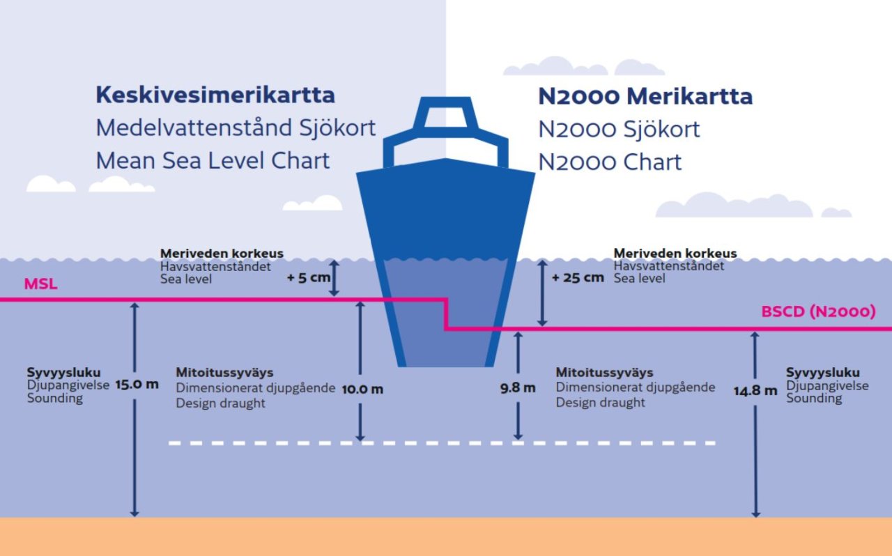
Finnish nautical charts and fairways will adopt a reference level for depth information that is tied to the N2000 vertical coordinate reference system. The migration to the new depth information reference level will affect the depth and fairway information presented in nautical charts. The change to the depth and fairway information presented in nautical charts will come as a result of the difference between current reference levels and the zero position used in the N2000 system. In sea areas this difference can vary between 10 to 20 cm depending on the area in question. In the future, those navigating in sea areas must pay closer attention to the real-time water level observations provided by the Finnish Meteorological Institute and the vertical coordinate reference system used in these observations.
Sea water level information can be found on the Finnish Meteorological Institute's webpage: Sea Level Ulkoinen verkkopalvelu.
The N2000 reform is part of the Baltic Sea countries’ joint BSCD2000 (Baltic Sea Chart Datum) project. The purpose of the project is to harmonise how nautical chart information and the available water depth data are interpreted. In the future, the depth information in a nautical chart can be combined with current water level data to ascertain the current available water depth – without any of the initial data requirements or calculations that are necessary in the current system.
The video below gives a concise explanation of what the reform means, what will change and what the benefits are.