Front Page: Traficom
Menu

N2000 fairway and nautical chart reform - Improved safety and efficiency

N2000 fairway and nautical chart reform

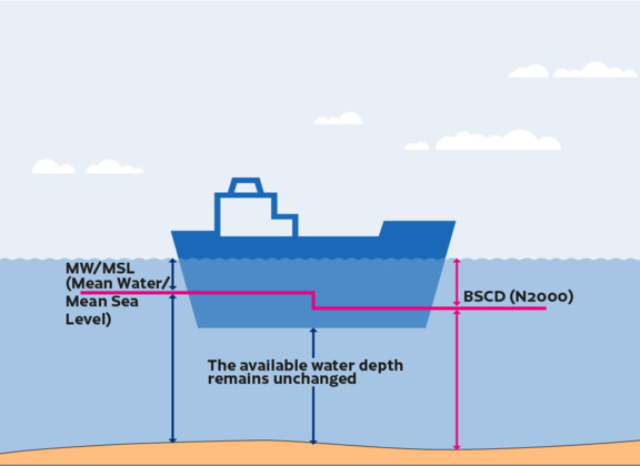
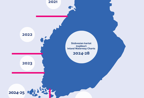
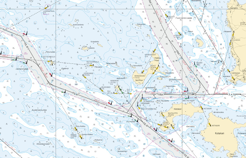
A new selection of nautical chart products and fairway depth information that are tied to the N2000 vertical coordinate reference system will be introduced gradually. The reform process started in the Bay of Bothnia region and the first N2000 charts were published in 2021. According to current estimates, the reform will reach full sea area coverage by 2026. The current, mean water level-based reference level for depth information for the sea area will be replaced with a reference level that is tied to the N2000 vertical coordinate reference system. The introduction of the N2000 vertical coordinate reference system, which is tied to the Earth's crust, will increase the compatibility of both national and international depth information.
The available water depth remains unchanged
Finnish nautical charts will be renewed one area at a time over the next few years as the N2000 fairway and nautical chart reform starting from the Bay of Bothnia introduces new and more detailed n...
The Finnish Transport and Communications Agency Traficom has published a new nautical publication, Sailing Directions for Finnish Waters. The publication contains general information about maritime...
The Finnish Transport and Communications Agency Traficom has published the instructions ‘Principles and application of channel depths in Finland’. The new instructions explain how channel depths ar...

What will the reform mean in practice?

Finnish nautical charts and fairways will adopt a single unified reference level for depth information which is tied to the N2000 vertical coordinate reference system. This reform will help simplify the process used to observe any changes in depth information – primarily as a consequence of land uplift – in practical maritime navigation activities.
N2000 laiva 1

Why is the reform being implemented?

Safe navigation, the efficient use of Finnish fairways, and future means of navigation – these all require more up-to-date and harmonised depth information that can be used in nautical chart products and by those navigating our waterways.
N2000 laiva 2

How will the reform be implemented?

Under the current plan, all nautical charts and fairway information will be renewed between 2021 and 2026. Those responsible for the maintenance of waterways will be contacted in connection with the changes made to the information concerning their waterways.
purje- ja moottorivene väylällä saaristossa

In collaboration with

N2000 yhteistyötahojen tunnukset: Traficom. Väylä, Ilmatieteen laitos, Syke ja Euroopan Komissio
See how you can contact us. Traficom is responsible for leading the reform, and the process also includes the Finnish Transport Infrastructure Agency, the Finnish Meteorological Institute and the Finnish Environment Institute. The reform receives support from the European Union.