Why is the reform being implemented?
Safe navigation, the efficient use of Finnish fairways, and future means of navigation – these all require more up-to-date and harmonised depth information that can be used in nautical chart products and by those navigating our waterways.
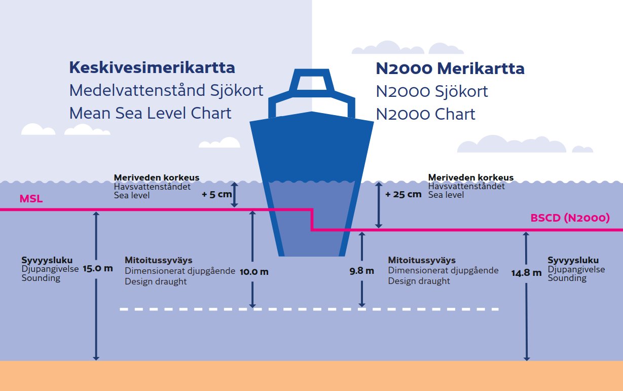
The current reference level that is used in nautical charts and Finnish fairways is the theoretical mean water or mean sea level (MW and MSL respectively). This level is time-dependent, meaning that the reference level shifts in relation to the Earth’s crust by a difference between land uplift and the general rise in sea levels. The theoretical mean water level is in practice an annually shifting reference level. The depth and fairway information included in Finnish nautical charts have not featured a unified zero level, and the charts used in different sea areas have featured differing zero levels as well. More information on the sea level height systems can be found on the website of the Finnish Meteorological Institute.
By adopting the N2000 system, we will be able to reduce the number of available reference levels to a single, well-defined level. All depth and fairway information in every nautical chart will adhere to the same system that is tied to the Earth’s crust. This will help clarify the current system, which has proven cumbersome due to how difficult it is to understand the joint influence that mean water levels and land uplift can have on it. In the N2000 system, the zero level is tied to the earth’s crust. Therefore, the system also accounts for land uplift when using water level information presented in the same reference system. Sea level at the measurement sites are presented on the website of the Finnish Meteorological Institute.
For more information on the effects of land uplift, see the website of the National Land Survey.